Case study
BeniciaBenicia Middle School, Matthew Turner Elementary, Robert Semple Elementary
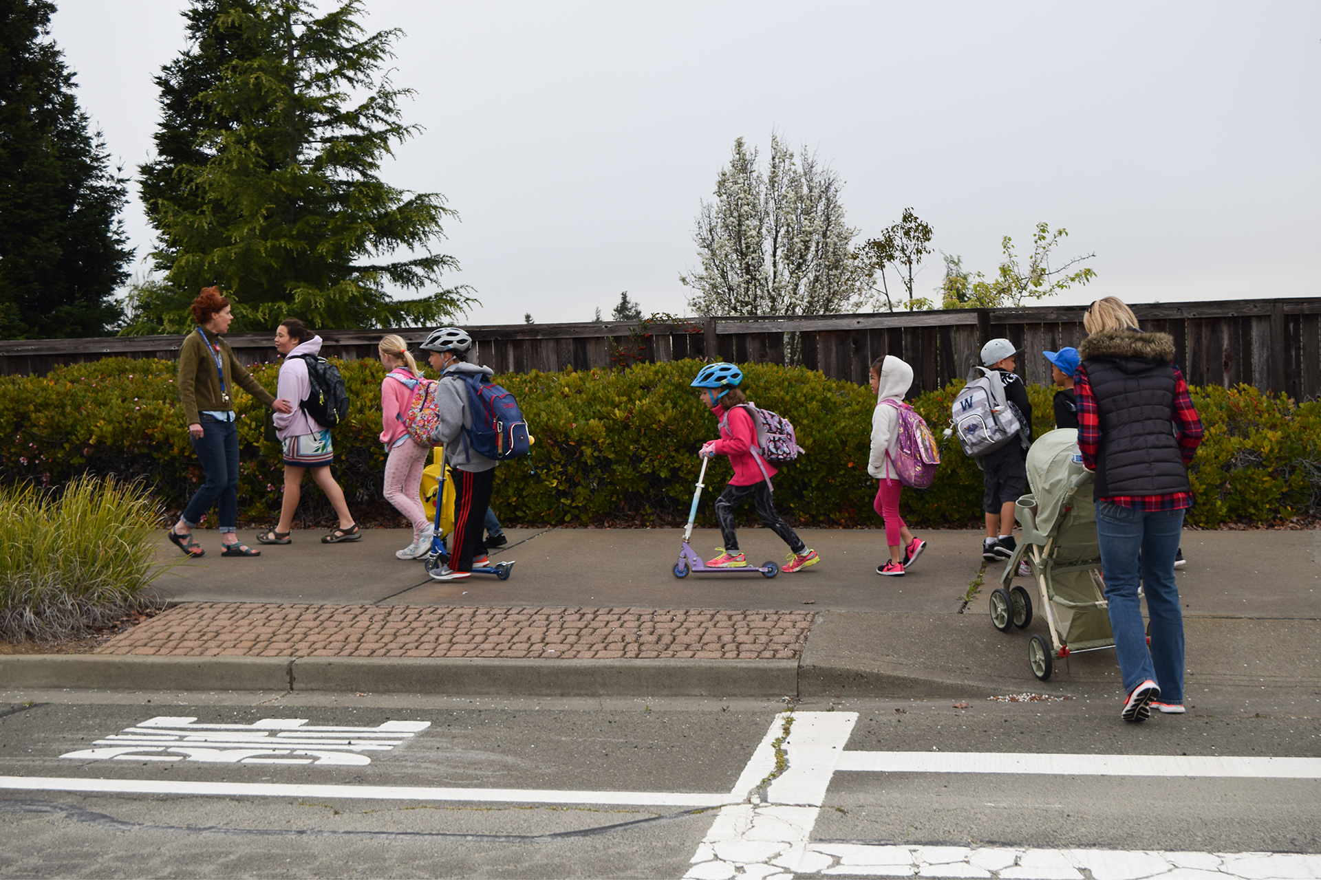
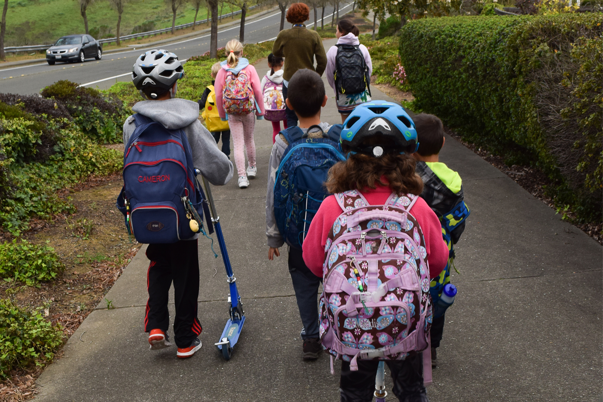
The Benicia Safe Routes to School Project included constructing safety improvements on routes to three Benicia schools as described below. These projects, which made it safer for children to travel to three Benicia schools, are included in the Solano Transportation Authority’s Countywide 2013 SR2S Plan.
Timeline
This Benicia Safe Routes to School Project (SR2S) followed the same environmental and design process as other federally funded projects, except with a more aggressive timeline to ensure the use of the funding within the time frame allotted. City staff was proactive in working with Caltrans on both the environmental and right-of-way clearance. The design portion of the project was split into three distinct tasks, each being done simultaneously by different agencies –City staff worked on one task and the remaining tasks were completed by separate design engineering firms. Completing this work simultaneously allowed for a faster delivery of the project.
Construction of the SR2S project commenced on July 22, 2014. While the work was underway, the affected streets remained open to traffic at all times. The project was completed in November 2014 and was accepted as complete by the City Council of the City of Benicia on December 2, 2014.
Benicia Middle School: Pedestrian activated flashing beacons were placed on both sides of Southampton Road at Turner Drive, in front of the Benicia Middle School, to assist students crossing this four lane arterial street. Before the project, there was only a crossing guard to stop four lanes of traffic for the students. The new flashing beacons provide a highly visible signal to vehicles that students are crossing the street.
Matthew Turner Elementary School: Sidewalk bulbouts, landings, and high visibility crosswalks were placed on Dempsey Drive to enhance safety for school children crossing from Matthew Turner Elementary School to the Community Park parking lot and Kearney Drive area. Before the project, numerous school children queued up on the narrow 4 foot sidewalk, cross Dempsey Drive, and either take the stairs down into the parking lot or cross the parking lot entrance (where there was no crosswalk) to access the sidewalk to the south. The new landings and crosswalks provide a safe refuse and highly visible path of travel.


Robert Semple Elementary School: Sidewalks were installed on El Bonito Way and Linda Vista to eliminate gaps in the pedestrian network leading to Robert Semple Elementary School. Before the project, the school children had to weave in and out of parked cars and walk in the street when raining to stay dry. The new sidewalks provide a dry, safe refuge to walk to school.
Results
The City’s SR2S Community Task Force, comprised of elected officials, City staff, and School District staff, met to update the SR2S plan. The Task Force also conducted walking audits at these Benicia schools, observing drop off and pick up activities at identified locations of interest and documented concerns. As a result of the walk audits, several recommendations for improvements were made to improve the traffic circulation, congestion and walk ability for children. The recommendations were reviewed and prioritized by the Task Force. These projects were subsequently included in the Solano Transportation Authority’s Countywide SR2S Plan Update and were approved by the Governing Board of the Benicia Unified School District on August 15, 2013.
The City of Benicia’s Safe Routes to School Project (SR2S) was the first SR2S project to be completed in Solano County during this SR2S grant cycle. Benicia’s SR2S project substantially improved travel safety for students by adding sidewalks, flashing beacons, sidewalk bulbouts, landings and high visibility crosswalks. The City of Benicia staff wanted to construct improvements on school routes in an effort to make travel easier and safer for students to cross and street as well as to encourage students to walk to school.
DixonWest B Street Undercrossing and Rehrmann Drive Green Bike Lanes
The crossing is located between N. Jackson Street and N. Jefferson Street in close proximity to Dixon’s downtown, Anderson Elementary School and adjacent residential areas. Although there are three at-grade crossings connecting residents to Dixon’s downtown, West B Street is the only Union Pacific Railroad (UPRR) approved crossing for pedestrians. The schools that will benefit the most from these improvements are CA Jacobs Elementary, Tremont Elementary, and Anderson Elementary.
Timeline
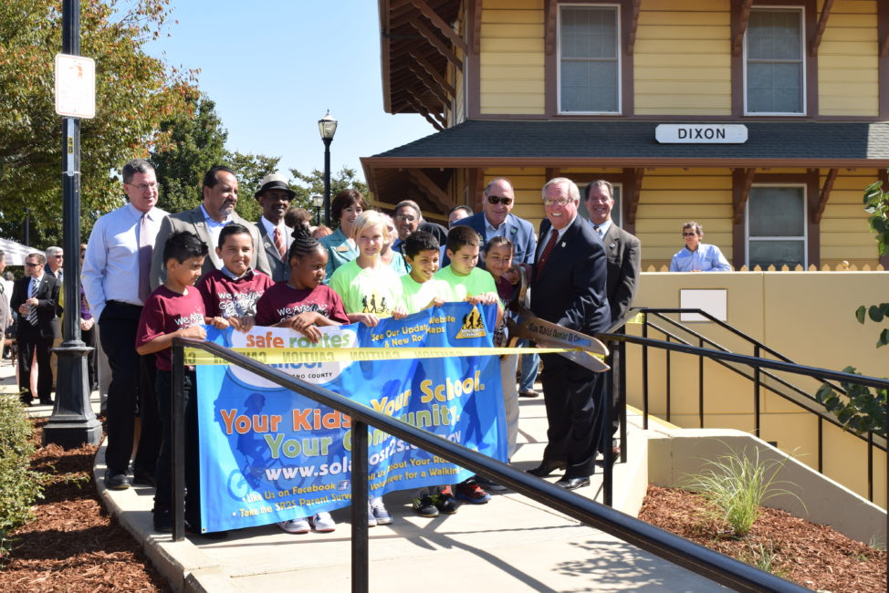
With two fatalities at this “at-grade” crossing, the City knew improvements must be made in this area. This location was identified by the City of Dixon in the 2004 Conceptual Plan showing an alignment for a grade crossing improvement. A community workshop, the City’s Transportation Advisory Committee meeting in August 2007, and subsequent City Council action recommended developing an underground crossing and directed staff to proceed. The Dixon West B Street Undercrossing officially opened August 8, 2014.
The project was funded through support of the Dixon Chamber of Commerce, Downtown Business Association, Solano Transportation Authority, and with funds from the City of Dixon, $2.5 million allocated from the Metropolitan Transportation Commission (One Bay Area Grant), $6 million in state and federal funds.
The Dixon Green Bike Lanes were completed in Spring 2018. The lanes were officially opened with a ribbon cutting and bike ride on May 9, 2018 National Bike to School Day. These high visability bike lanes are the first of their kind in Solano County.
Dixon West B Undercrossing Provides Safe Travel for Pedestrians


Solano County’s First Green Bike Lanes Open in Dixon
On National Bike to School Day May 8, 2018, the City of Dixon, local elected officials, the Safe Routes to School Program, members of the Bicycle Advisory Committee, CA Jacobs Middle School students and Solano Transportation Authority celebrated the completion of Solano County’s first Green Bike Lanes. The lanes run along Rehrmann Drive between CA Jacobs Middle School at North Lincoln Street and past Tremont Elementary to Evans Drive. The green painted lanes make it easier for motorists to be aware of the bike lane and riders. Celebrants at the event took to two wheels to participate by riding on the lanes. The new Green Bike Lanes were constructed using Transportation Development Act Article 3 funds.


Results
The West B Street Project replaces an existing at-grade pedestrian crossing at West B Street with an underground concrete tunnel for use by pedestrians and bicycles. The new facilities include the 200-foot tunnel, stairs and accessible ramps, security fencing and courtyard areas with lighting, landscaping and irrigation, and a security system consisting of cameras (transmitting images to the Dixon Police Department) and emergency call buttons. The Project serves pedestrians and bicyclists daily, the majority of which are school children who are able to avoid the 32 Capitol Corridor passenger trains and 6-12 daily freight trains. The Green Bike Lane Project provides a high visability lane for bicyclists riding along Rehrmann Drive. Students at CA Jacobs Middle and Tremont Elementary Schools can benefit from the lanes to get to and from school, reducing vehicle traffic around the schools during drop-off and pick-up times.
FairfieldFairview Elementary School
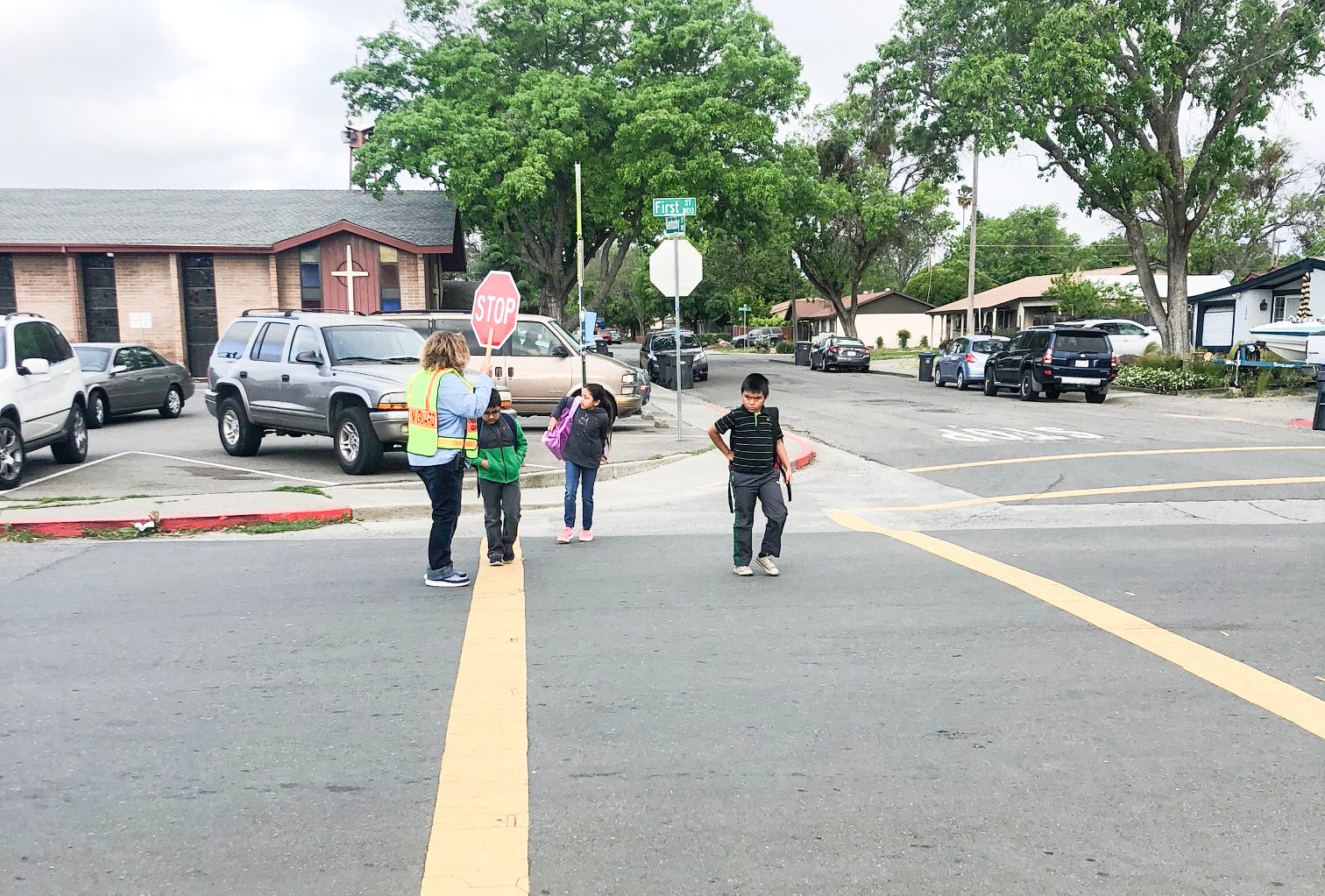
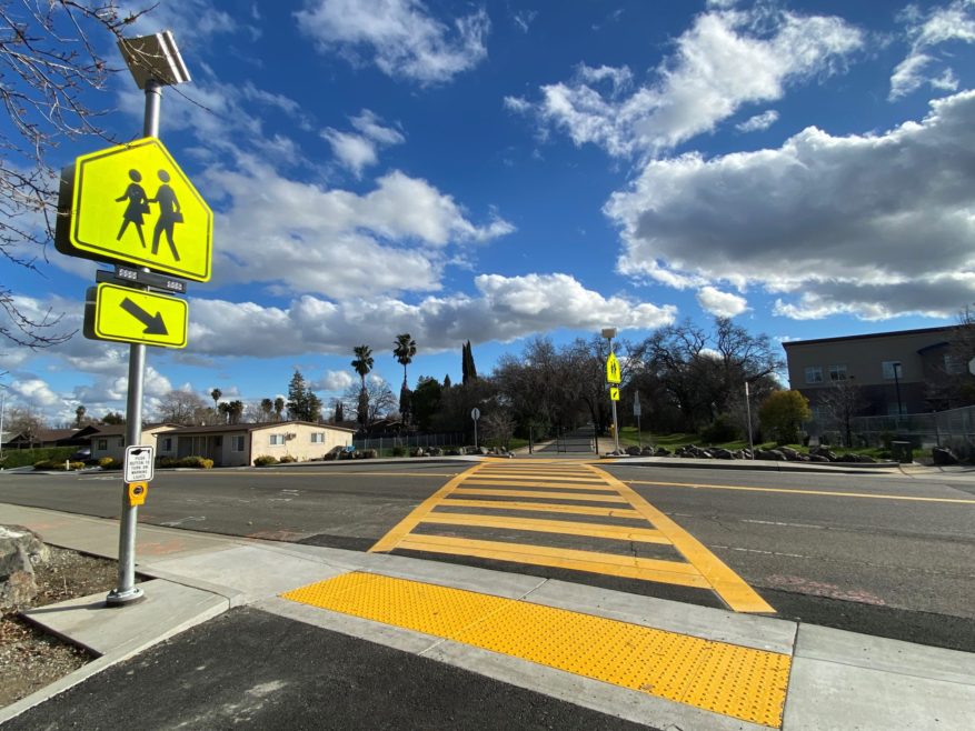
A Rectangular Rapid Flashing Beacon (RRFB) was installed in early 2021 to improve the safety of the existing crosswalk in front of Fairview Elementary. Located at the intersection of 1st Street and Kentucky Street, this crossing is also supported during school arrival and dismissal times by a school district crossing guard. This project will increase the safety for students and the community by alerting drivers of pedestrians crossing.
Timeline
In 2018, as part of the SR2S Evaluation and Intervention Project, SR2S staff joined Principal Porter, City of Fairfield engineering staff, and a school volunteer to conduct a walkability assessment to identify potential improvements around the school. The resulting list of improvements would increase safety and encourage more students to walk or bike to school. At a follow-up site review with members of the Fairfield 3Es committee (City of Fairfield Traffic Engineering and Police Department representatives, Fairfield-Suisun Unified School District Facilities staff, and SR2S staff) reviewed the suggested improvements from the walk audit. It was determined that a Rectangular Rapid Flashing Beacon would improve the safety of this crossing located directly in front of the school. With funding provided from the City of Fairfield Police Department, public works installed this RRFB at the intersection of 1st Street and Kentucky Street. Installation was completed in early 2021, while students were in distance learning due to the COVID-19 pandemic, and is ready when students return to in person classes.
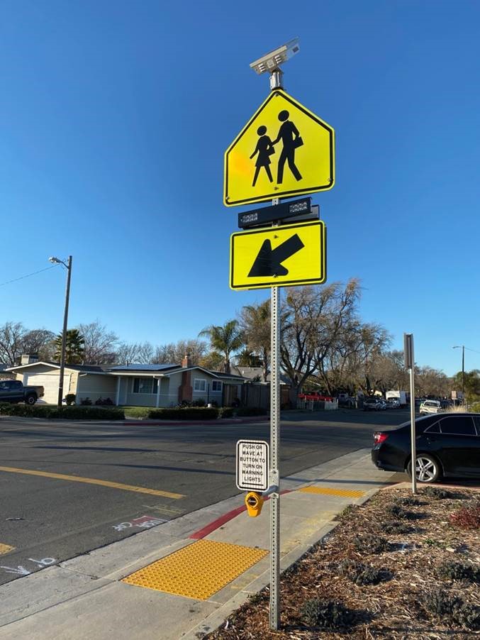
This new RRFB allows for passive activation of the lights. Pedestrians and bicyclists can push the button, or wave a hand in front of the sensor to activate the signal.
Rio VistaSR 12 and Gardiner Road, Montezuma Hills Path
The SR 12 crossing at Gardiner Way in the City of Rio Vista is a well-used pedestrian route for students that live on the west side of Rio Vista that attend D. H. White Elementary located on the east side of SR 12. Before the updated crossing, in pavement flashing lights were present at the crossing. The project identified the need to repaint the crosswalk, and add an overhead flashing pedestrian warning light for motorists.
In June 2020, the City of Rio Vista completed an all weather path along Montezuma Hills Road. With funding from Senate Bill 1 and the Yolo-Solano Air Quality Management District, the new path replaces the existing pathway made of decomposed granite. This original pathway often washed away during the winter rains, making it difficult for students and residents to use the path for walking or biking. The new multi-use path connects the Vineyard Bluffs subdivision and Riverview Middle School, with the goal to help reduce vehicle traffic along this route.
Timeline
In 2002-03, the City of Rio Vista was granted funding to install a lighted crosswalk on SR 12 at Gardiner Way. At the time the crosswalk was installed at to current Caltrans standards. The project was constructed with in-pavement flashing lights, and was the only regulated crossing on SR 12, other than the signal light installed in 2002-03 at Hillside Terrace Way.
In the 2013 SR2S Plan, updating this Project was identified as a priority. The City of Rio Vista was allocated $100,000 from Safe Routes to School (SR2S) Funds to install a new lighted crosswalk at SR 12, replacing the existing in-pavement lighted crosswalk. The City Engineer and staff worked closely with Caltrans and STA staff to develop a set of plans and specifications to meet the new standards for lighted crosswalks within the budget allocated from the available SR2S Funds. The Project went to bid in April 2016 and construction started in early September 2016 and the project was completed in early Fall 2016.


(above – SR 12/Gardiner Way crossing prior to improvements)
The Project was supported by the City of Rio Vista, Caltrans and the Solano Transportation Authority for use by bicyclists, pedestrians, and students that need to cross from the west side of SR 12 to the to attend D. H. White Elementary, and for students crossing to attend school at Riverview Middle, and Rio Vista High School.
Prior to the construction of the overhead lighting, ADA Curb Accessibility and crosswalk, the City of Rio Vista Police Department (RVPD) conducted crosswalk enforcement exercises to educate drivers and pedestrians on crosswalk laws. The SR2S Program works with the RVPD under the Program’s Public Safety Enforcement and Education Grant. This gratn funding provides additional Enforcement and Education activities around driver safety, bike and pedestrian safety, and support for SR2S program efforts within the City of Rio Vista, D. H. White Elementary, Riverview Middle and Rio Vista High Schools.


Results
The new SR 12 Lighted Crosswalk at Gardiner Way is a milestone for safety in comparison with the previous lighted crosswalk for the safety of bicyclists, pedestrians, and students to use every day. The previous lighted crosswalk was limited in visibility and ADA access, although designed to Caltrans specifications at the time of construction.
This new lighted crosswalk allows for the ability of approaching cars and trucks to see the people in the crosswalk. This lighted crosswalk is of regional significance for bicyclists, pedestrians, and visitors who come to Rio Vista to visit the SR 12 corridor, Downtown Rio Vista and the Waterfront Areas. With more bicycle and pedestrian planned Complete Street improvements within the SR 12 Corridor, and the Downtown and Waterfront Areas, the need and use of such a safe lighted crosswalk is even greater during special events like the Annual Bass Derby and more planned events along the newly completed waterfront Promenade Phase II Project.
Suisun CityGrizzly Island Trail
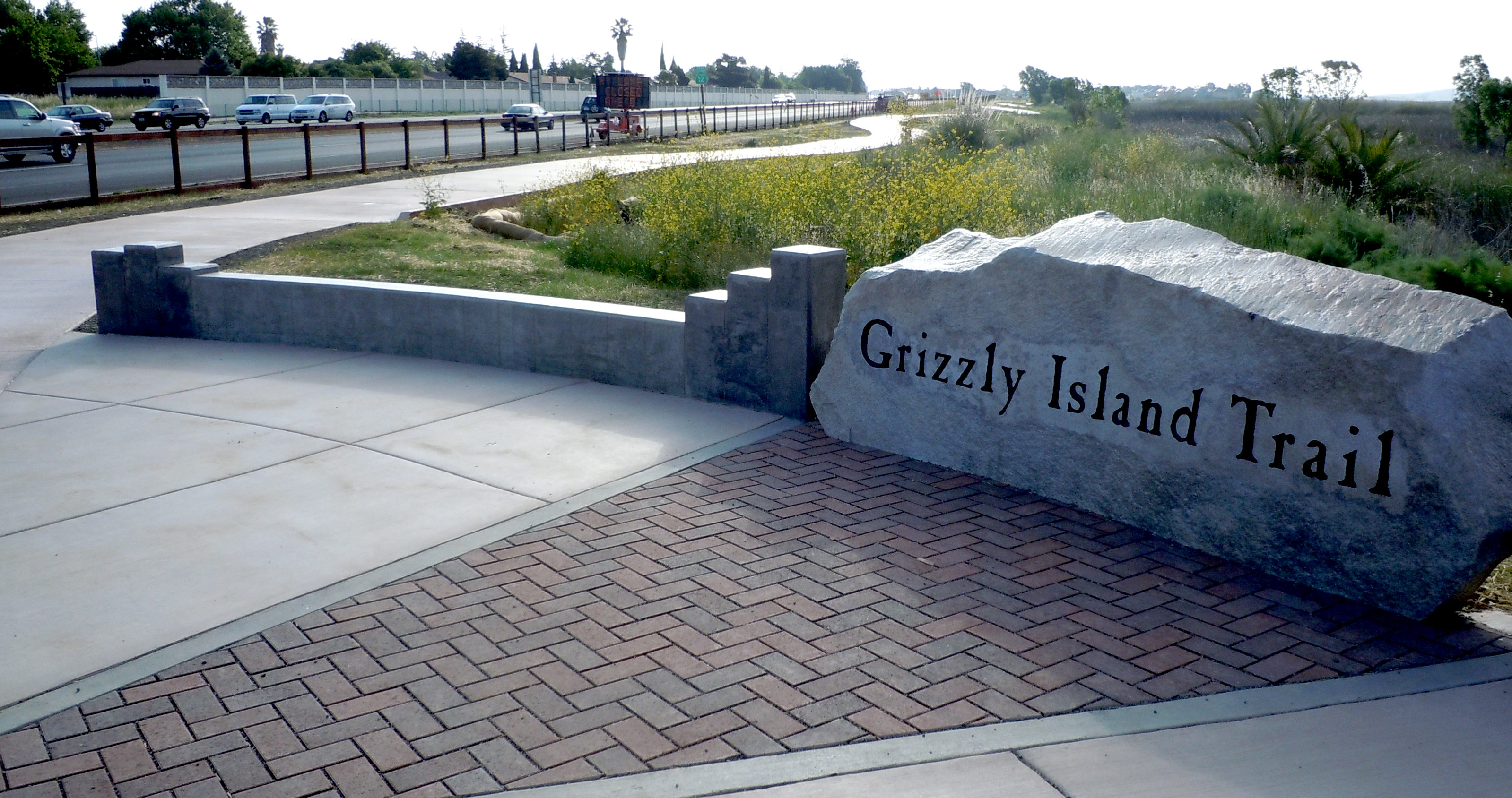
Suisun City is bisected by State Route 12, dividing the City into a northern and southern half. In addition, the southern half of Suisun City is divided into eastern and western zones by the Suisun Marsh located between Grizzly Island Road and Marina Boulevard. These divisions have created an unsafe environment for students who live within the southern residential districts of Suisun City and who attend either Crescent Elementary School or Crystal Middle School. Before completion of this porject, students who attend either school within the opposite zone of their homes would have to travel to school along the borders of State Route 12 and cross this highway twice to gain access to their schools.
Timeline
June 2010, consultants were awarded the contract to perform environmental studies and prepare environmental reports. In May 2012, construction of the trail began.
This project brought together multiple agencies to address the proximity to the Suisun Marsh, Travis Air Force Base, and the concern for wildlife in the area.
Design feedback and input was provided from: Solano Transportation Authority, Caltrans, Fairfield-Suisun School District, Department of Fish and Game, Wildlife Conservation Board, San Francisco Bay Conservation and Development Commission, San Francisco Bay Regional Water Quality Control Board, US Fish and Wildlife Service, CA Parks and Recreation, Travis Air Force Base, Fairfield-Suisun Sewer District, AT&T, PG&E. This project is a model of multi-agency cooperation to provide an essential safety project for the Suisun City community.
This project reduces fears parents have about their children having to cross SR 12 or travel along the busy roadway on their way to and from school. The end result includes fewer vehicle trips by parents and an increased number of walking/bicycling trips by students. Other alternatives involving education, encouragement and enforcement have been explored and are being implemented at the two subject schools, Crescent Elementary School and Crystal Middle School.
Not only is this trail a Safe Route to School project, it is also a Safe Route to Transit project as it provides a connection to the multi-modal transit station on Main Street and Lotz Way, located only four blocks east of the trail entrance at Marina Boulevard and Lotz Way.


Results
This project promotes the social benefits to the community by allowing residents to gain a direct and safe route to the Suisun Marsh; multi-modal transit station, recreational facilities and the Historic Downtown Waterfront District which has been established as a focus of community activities which include, but not limited to, car shows, weekend musical performances, summer jazz festivals, antique fairs, the Harbor Day festival, and the popular July 4th fireworks show which attracts more than 20,000 spectators.
This project also establishes needed links to concentrated residential developments and connects neighborhoods to the schools, employment centers, shopping areas, recreational destinations, and Downtown Suisun, as well as to Downtown Fairfield and the County offices via an existing pedestrian bridge crossing over the railroad tracks.
Vacaville – HSIP Cycle 9 Projects (2020)Marshall Road at Southside Bikeway
The Highway Safety Improvement Program (HSIP) provides funding for local safety projects that will reduce crashes and fatalities on public roadways. Projects must be identified based on crash experience, crash rate, crash potential, or other data based means. Projects eligible for HSIP include (but are not limited to): pedestrian crossing improvements, guard rail extensions, pavement or shoulder widening, traffic calming, etc.
In 2018, the crossing of the Alamo Creek Bike Path at Marshall Road was identified as a potential project for HSIP Pedestrian Set-aside funding. Each local agency has $250,000 in available funding per cycle to apply for safety related improvements. The City of Vacaville in partnership with STA applied for HSIP Cycle 9 funding for crossing improvements at this location and Browns Valley Parkway at Waterford/Clarescastle. These locations serve students as they travel to school.
In 2018, as part of the Padan Elementary School walk audit with SR2S and City of Vacaville Traffic Engineering staff, Principal Cicely Rodda expressed her concern over the lack of a marked crossing at this location for students and families that walk and bike to Padan Elementary and Vacaville Christian High School using the Southside Bikeway trail. When school is in session, Padan Elementary holds a weekly Walk or Wheel (WOW) Wednesday event that encourages student to skip the car and walk, bike, skateboard or scooter to school.
City of Vacaville staff recognized this as a potential location for a high visibility crossing and included the location in the HSIP Cycle 9 Pedestrian Set-Aside application. Funding was awarded for a new crosswalk, ADA accessible curb ramps and Rectangular Rapid Flashing Beacons (RRFBs). Construction of the project was completed in 2020.
VacavilleVacaville High School, Vacaville Christian School, and Foxboro Elementary School
This Vacaville Safe Routes to Schools project was funded through OBAG and YSAQMD funds, and was supplemented with $30,000 of local funds. This project consisted of significant pedestrian infrastructure improvements at Vacaville High School, including sidewalk widening, adding sidewalk to close pedestrian gaps, constructing new ADA accessible curb ramps, crosswalk shortening, and the addition of Class II bike lanes and/or share-ows. The project also closed a pedestrian gap with new sidewalk adjacent to Vacaville Christian School, and installed new crosswalks, ADA accessible curb ramps, Rapid Flashing Pedestrian Beacons, and advance pedestrian crossing signing at Foxboro Elementary School.
Timeline
This project was managed and designed in-house using Vacaville Public Works Engineering Division staff. Staff requested authorization to proceed with preliminary design, environmental and design work from Caltrans in January 2014. Staff then requested authorization to proceed with construction from Caltrans in September 2015. Authorization was approved, however, due to the need to coordinate our SR2S project closely with major on-site improvements at Vaca High school as well as the summer break, and school closure, the construction was delayed until summer 2016.
Due to a very poor bidding climate the project had to be advertised for bids twice in order to finally secure a responsible, responsive bidder. The project was awarded to Lister Construction for $260,000 in June 2016. Due to the later than planned start as a result of the re-bid, staff included specific milestones and associated liquidated damage penalties to ensure that the major work at Vaca High School was completed prior to school being back in session. The creative strategy worked nearly perfectly; and the construction of the Vaca High portion of the project was completed a week before school started, and the roadway was being striped the third day of class.

To assist the City of Fairfield with staffing constraints, and insure the SR2S funds were expended timely, Vacaville partnered with the City of Fairfield and the STA to re-appropriate SR2S funds that were originally allocated to Fairfield for use in the Travis Unified School district to the City of Vacaville since we have two schools also in the TUSD. This allowed Vacaville to provide needed pedestrian improvements at Foxboro Elementary School, freed up Fairfield staff for higher priority Capital projects, and still allowed STA to deliver the SR2S project for TUSD successfully.
Results
This project is significant simply by its nature, providing enhanced pedestrian facilities and pedestrian safety features at three separate schools. But the Vaca High portion of this project is of the most significance for several reasons: the magnitude of the improvements, the pedestrian related accident history at the school, and the coordination and cooperation with the VUSD and their major improvement project at the high school.
1) This project was able to replace old 4’ wide sidewalks with wide sidewalks along Monte Vista Ave to accommodate the pedestrian traffic; and it also closed several large sidewalk gaps where there was no place for pedestrians to walk, forcing them into the street;
2) There is unfortunately a long history of vehicle-pedestrian accidents at Vaca High School. By providing sidewalk improvements for capacity and continuity under this SR2S program; as well as implementing the traffic calming improvements near Monte Vista and West Street, such as bike lanes, road narrowing, and shortened crosswalks, we hope to see a reduction in these type of occurrences;
3) Finally, this project coincided perfectly with the major parking and circulation improvements that the VUSD was managing at the high school. The two projects truly complement one another in their quest to make Vaca High a safer, more traffic friendly place for drivers and pedestrians in and around the school. There was a lot of coordination between the VUSD staff and Vacaville PW staff to insure a smooth completion, and final products are evidence of the success of that coordination.
VallejoJoseph Wardlaw Elementary School
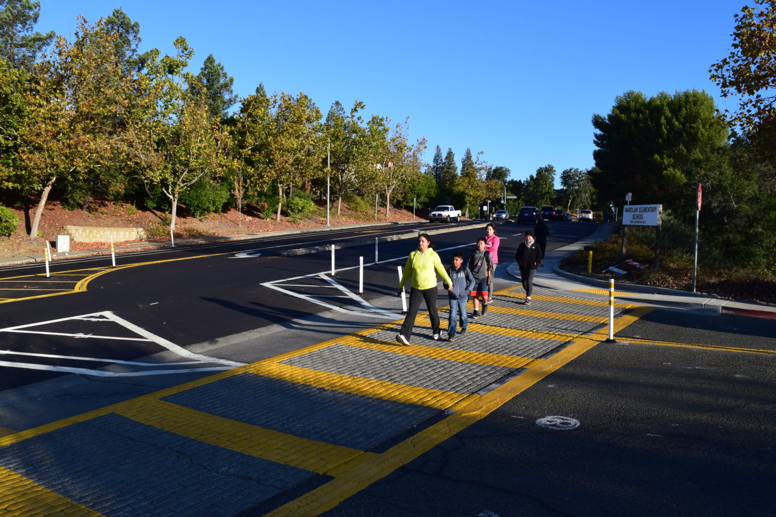
In Fall 2016, a SR2S Priority Safety Project was completed at Joseph Wardlaw Elementary School in Vallejo with funding from the One Bay Area Grant (OBAG) and local funds from the City of Vallejo. The project was led by the City of Vallejo’s Senior Civil Engineer Allan Panganiban and staff, based on recommendations made from the Vallejo SR2S Community Task Force as part of the 2013 updated Safe Routes to School Plan. The City also met with Principal Juli Robbins to discuss the project and outreach to parents and neighbors during the construction and information was displayed through signage and on the website.
Timeline
In April 2015, the City of Vallejo presented the OBAG SR2S Engineering Project at Wardlaw Elementary to the Vallejo Safe Routes to School Community Task Force meeting as a priority project for construction
At the February 2016 meeting, the City announced that pre-construction work had started and the project construction would begin in the summer of 2016.
The Project was completed in September 2016.
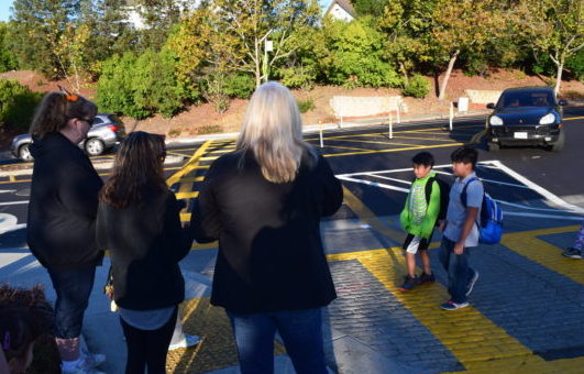
At the main entrance of Joseph Wardlaw Elementary School, on Oakwood Avenue, there is heavy congestion before and after school and cars travel at a high rate of speed on this street. Oakwood Ave. is the only road providing vehicle access to the school parking lot. To alleviate the traffic issue, engineering improvements were made on Oakwood Drive from Redwood to Tennessee, by implementing a “road diet.” The road was re-striped to allow for 2 lanes of traffic, one for each direction, with a turn lane in the middle. This allowed for parking on either side of the street and a bike lane. The entrance to the school was also reconfigured, upgrading the handicap curb ramps and the left turn exit from the school entrance was eliminated, greatly easing congestion.
Results
Through the City of Vallejo’s efforts at Joseph Wardlaw Elementary School, traffic was significantly reduced on Oakwood Avenue and the street is much safer and more comfortable for students and parents to walk and bike to the school. The Safe Routes to School Program will continue to provide programmatic support and evaluate and monitor progress to see if these changes are influencing more students to walk or bike to school.